5 days mountkenya unique trekking-sirimon up down chogoria route
Day 1: Nairobi to mountkenya trekking sirimon route ascent
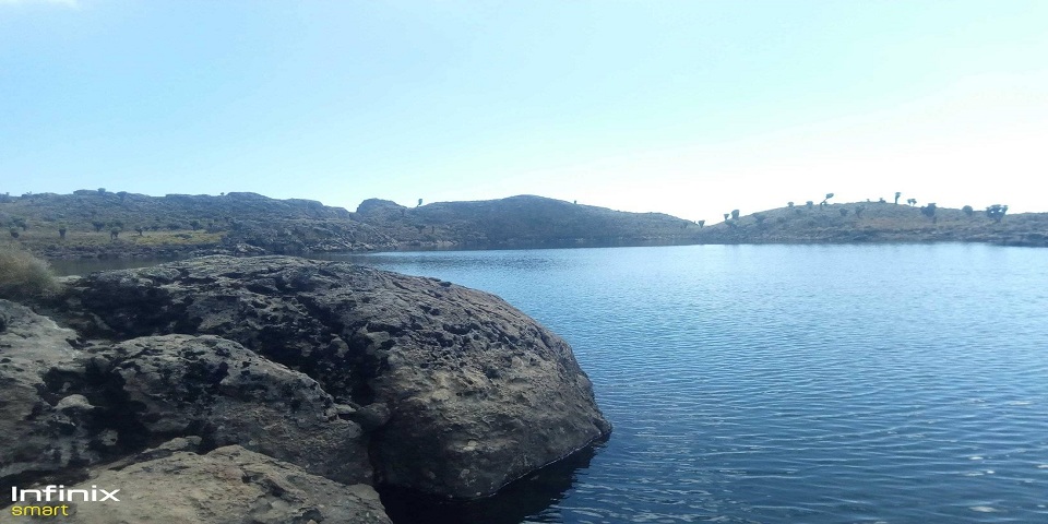
After picking you up at your hotel,our journey starts to the mountain region of nanyuki arriving in time for lunch.then further drive to mountkenya sirimon gate 2650m.the trek and covers a distance of 9km.wildlife found at this altitude are bamboons,elephant, bufalloes,zebras,giraffes and birds.from the sirimon gate you can see the table mountain,and the peaks of mtkenya.the vegetation found at the altitude is giant heathers,tussock grass.the elevation bus gradual,so it is an easy climbing.the trek ends to oldmoses camp 3300m, walking around the camp is optional.
Day 2:oldmoses camp(judimaire camp to shiptons camp.4200m 14km distance 900m elevation.
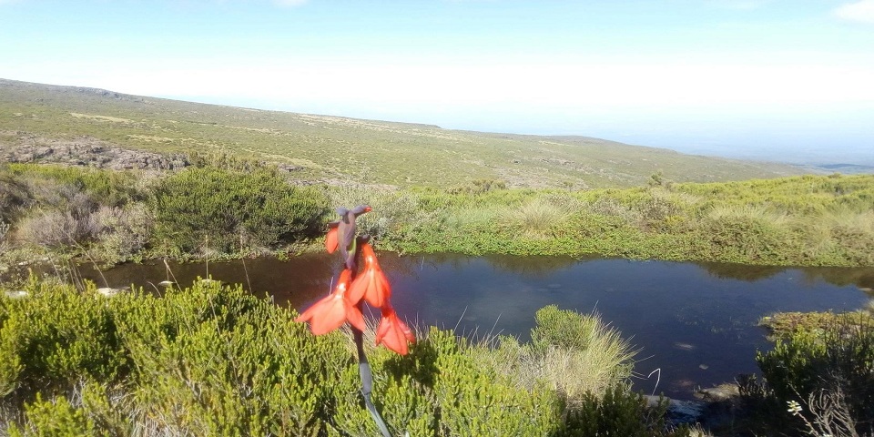
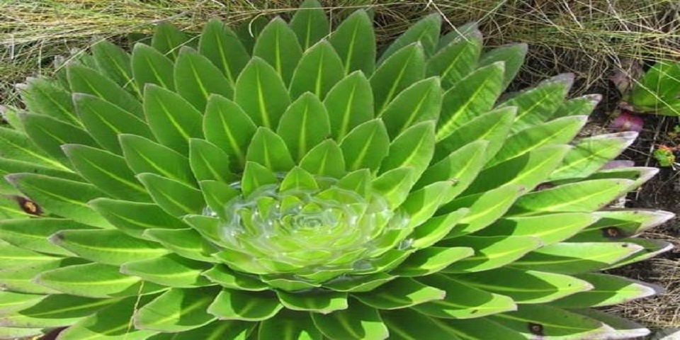
The trail is not defined,it’s zig zag in nature and some trail are created by the rain water so this route is not easy to walk when you are the first and fast hiker.the bushes are shorter not like the fist day.the rock and peaks are easily seen,the distance is more than the first day.altitude elevation may be experieced from 4000m,the walk is along the mackinders valley,the giant Heather flowers,red hot porker,scenecios and water lilly lobelia,giant lobelia,are plants that can survive the altitude.lunch may be served on the half way trek.hikers are adviced on the altitude problems.some of the features on this route are sedeo and terere peaks,the camp on this route is shiptons camp.
Day 3: Acclimatisation day.
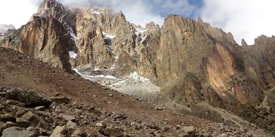
Acclimatisation is advised on the shiptons camp,this is to make the body used to high altitude, walking up and down makes you your body fit for the summiting day.the 4200m altitude is sorounded by high peaks,namely batian peak,nelion peak,dalton peak,point john,point peter,the glaciers may be seen but on high altitude when the snow showers,the temperature in mountkenya are from -15 to +5 degrees.so warm clothes are needed.
Day 4:summit attempt to.point lenana.elevation distance is 23 km

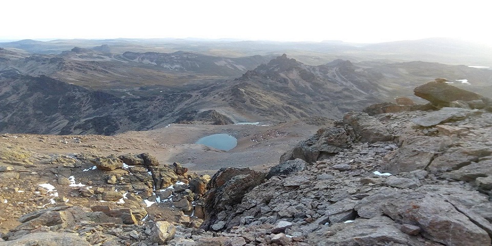
Early morning at 3:00 o’clock is the best time to attempt the summit for those who are interested to see the sunrise.this takes 3 hours walking,in the dark,loose rocks and vertical bogs are walking styles.the main peaks are easily seen,at the summit you may see kilimanjaro when the weather is good, sometimes may be windy and snowing,so it’s advisable to wear the best mountain gears.the journey is long to chogoria route,but the most beautiful,along the gorges valley, through the simbacore tarn,and highest lake in mountkenya(halis tarn) and lake michaelson lake.lake ellis ( the biggest lake in mtkenya is olso seen on this descent route.chogoria route was named after chogoria town.the distance may be long but easy while going down.
The scenic sceneries on chogoria route are nithi falls,mugi hill,and urumandi hills.the trail from road head camp is 7km,from this point the vegetation is plenty.
The chogoria forest is huge compared to the other routes.wildlife may be seen while walking down after conquering mountkenya.overnight camp is at banda’s camp.near chogoria gate.2950m
Day 5:banda’s camp to 5 km walk to chogoria forest.
After conquering mountkenya we walk through the chogoria forest,it is a very beautiful forest compared to sirimon route,it forms a canopy and forms the a cool breeze.walking for 5 km is easy before youmeet the transport back to Nairobi
The prices includes.
Transportation to mountkenya
Park entry fees
Mountkenya guides and porters
Cook
Food in the mountain
mountkenya camping or huts accomodations in oldmoses huts,shiptons hut,banda’s camp
Exclusion of
Tips
Beverages such as beers and sodas
Any other not mentioned above.